<home # start here # guides # builds # services # shop # about # categories>
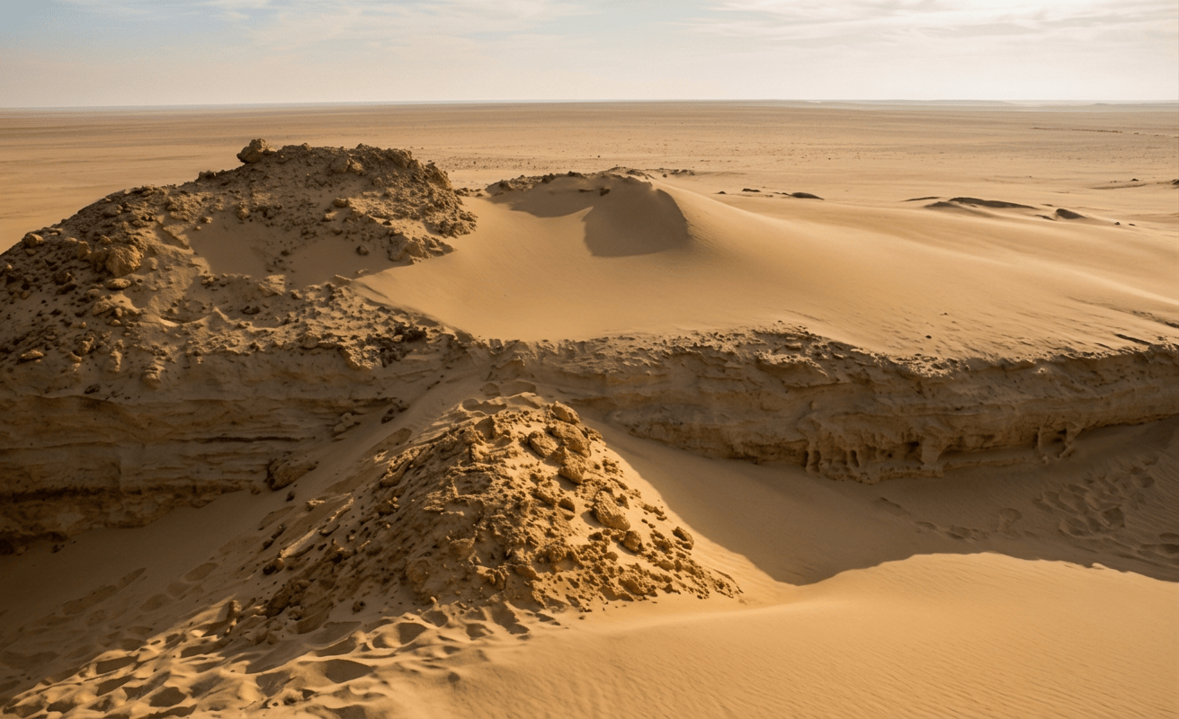
Kom W and Kom K are among the most important Neolithic archaeological sites in Egypt. Not because they contain spectacular houses or temples, but because they preserve the evidence for a completely different kind of early farming society
They lie on the northern edge of the Fayum Depression, beside what was then a much larger Lake Qarun. People combined fishing, hunting, gathering, livestock and cereal cultivation. They made pottery, stone axes, sickles, baskets, textiles and sophisticated storage systems. Yet archaeologists still cannot confidently reconstruct a conventional village of permanent houses.
It makes Kom W and Kom K particularly valuable for Neolithic Architecture: they challenge the assumption that farming automatically means permanent houses and sedentary village life. Recent landscape research suggests a more flexible system of occupation and mobility. (1–6)
Where are Kom W and Kom K?
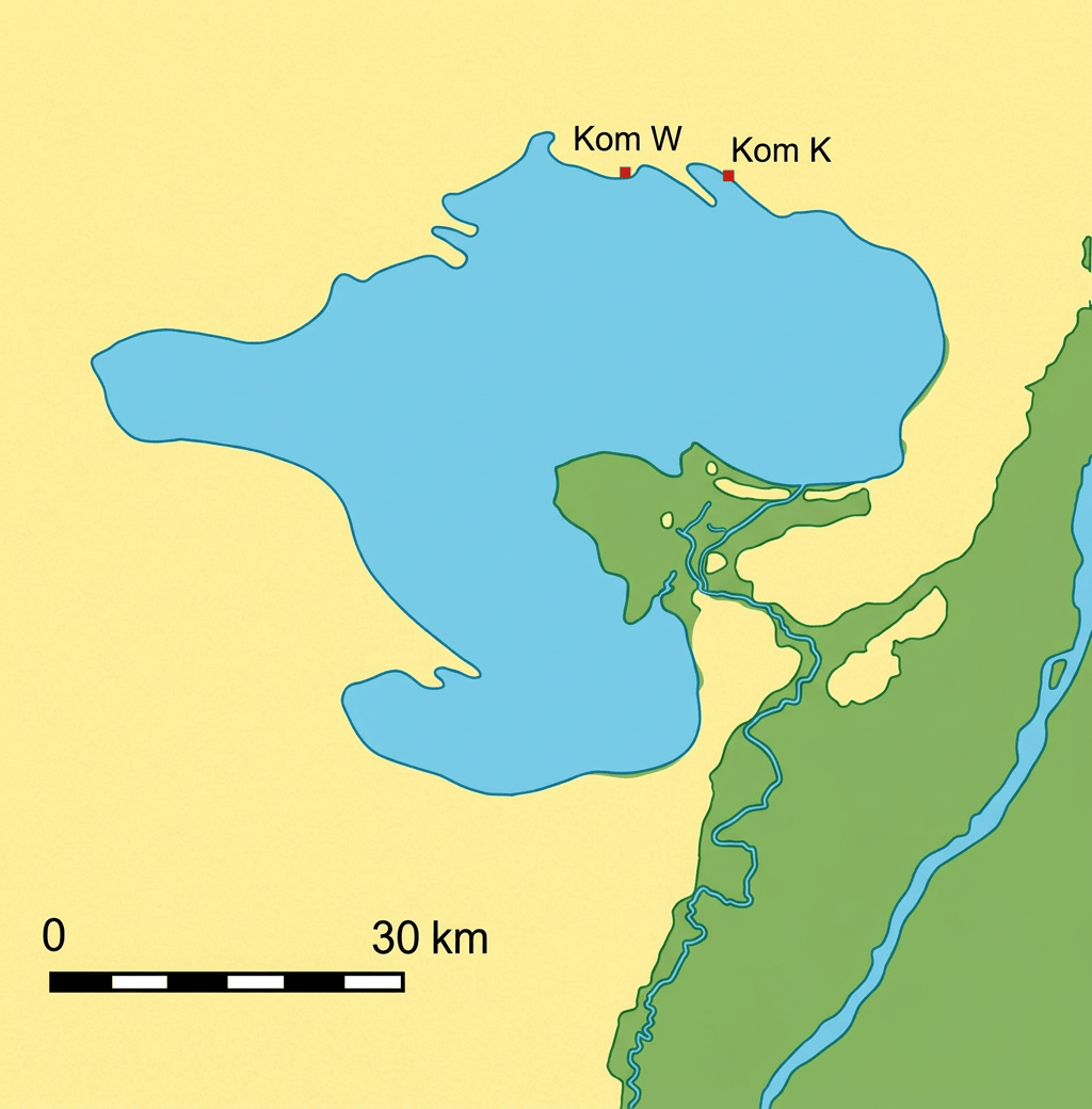
The two sites are on the northern shore of the Fayum Depression, in Egypt’s Western Desert, north of modern Lake Qarun. They are roughly 10 km apart, with Kom K east of Kom W. Kom K is now surrounded by agricultural land, while Kom W remains in a more desert-like landscape. (1,2)

The Fayum is not beside the main Nile channel
The depression is separated from the Nile Valley by the Nile-Fayum divide, and ancient Nile floodwater entered the depression through the natural Hawara/Bahr Yusuf system. So Kom W and Kom K were perhaps better described as Nile-connected lake settlements rather than ordinary Nile-bank settlements. The Nile was their ultimate water source, but the water immediately around them was Lake Qarun and associated wetlands, channels and groundwater.
Lake Qarun was much larger
This is probably the single most important environmental fact about the sites. Today, Lake Qarun lies roughly 8 km south of Kom W and Kom K. But that is misleading. During the Early and Middle Holocene, archaeological and geomorphological evidence indicates that Kom W and Kom K were much closer to the lake shore. During their occupation they were probably within roughly a kilometre during important phases. (2,3) So imagine the modern map with the lake pulled northward. The settlements were effectively lake, marsh, settlement and desert. Rather than desert, 8 km of empty land and lake.
Lake Qarun’s prehistoric level fluctuated in response to: Nile flood discharge; the connection between Nile and Fayum; rainfall; evaporation; groundwater; and basin geometry
Geomorphological research identifies episodes of lake advance and retreat, but researchers emphasize that the exact prehistoric inundation history is still debated. (2,5) It was not as simple as “African Humid Period ended, lake moved south and people left. The actual system was more complicated.
What was happening around 8,000 years ago? There was an earlier occupation of the Fayum long before Kom W and Kom K
The Qarunian/Epipalaeolithic occupation dates roughly to the 8th–7th millennium BC, with some of the earliest Fayum archaeological evidence around 7400 cal BC. (7,8) These earlier people were principally: fishers; hunters; and gatherers. They did not have the agricultural package of the later Fayum Neolithic. There is then an important occupational gap before the later farming communities appear.
Around 6,000 years ago was fascinating. The African Humid Period was weakening, while Nile hydrology was fluctuating
Lake Qarun experienced episodes of changing water level, and the Fayum’s landscape became increasingly sensitive to variations in Nile floodwater and rainfall. Earlier work has identified major low-water episodes around 8500, 7500–7000 and 6000 years BP, although the exact chronology and mechanisms continue to be investigated. (9) Thus by the time farming communities returned to the Fayum, they were living in an environment in which water was abundant enough to support a major aquatic ecosystem, but not necessarily stable enough to make farming the only sensible economic strategy. That helps explain the remarkable mixed economy.
The best modern AMS radiocarbon evidence places the principal occupation of the stratified Kom W and Kom K deposits at approximately 4650–4350 BC
Roughly 6,600–6,300 years ago. The occupation represented by the stratified mounds therefore lasted approximately three centuries or less. (3,10) Kom W and Kom K should not be treated as the entire Fayum Neolithic.
What did the landscape look like? Forget today’s desert
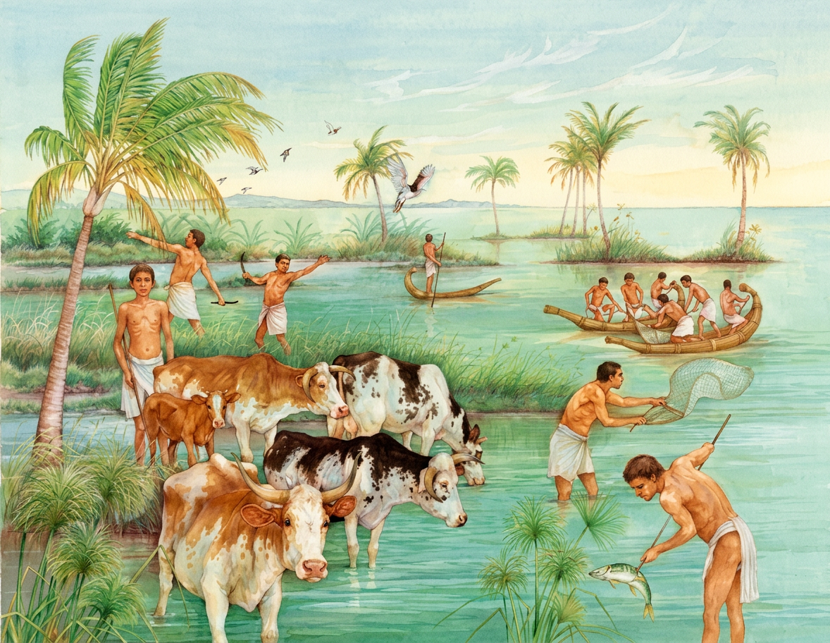
At its best, the Fayum was a spectacular ecological mosaic: large freshwater lake, marshes and shallow-water margins, grassland, seasonally wet ground, cultivated fields, open desert and higher rocky/gravel terrain. This was not a forested environment like Neolithic Anatolia. But it was considerably greener and wetter than the modern desert.
Forest or woodland?
There is no good reason to reconstruct a dense forest surrounding Kom W. The landscape was probably dominated by: open grass/herb vegetation; marsh vegetation; reeds; scattered trees/shrubs; lake-margin vegetation; and desert plants. Wood was nevertheless available and important enough that the Fayum has produced evidence for substantial prehistoric wood exploitation. Modern research has specifically investigated Early and Middle Holocene wood use in the Fayum basin. (11) It was probably wetland woodland patches and scrub, within a largely open landscape, rather than forest.
The most important agricultural plants were: Cultivated. Emmer wheat, hulled barley and flax. The Upper K storage pits provide particularly strong evidence for emmer and six-row hulled barley. (2,12)
Wild plants. The archaeological record also includes wild plants, grasses and other vegetation, although preservation is uneven. The important point is that the community did not depend entirely on cultivated crops.
The extraordinary Upper K granaries
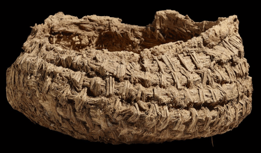
About 800 metres north of Kom K, archaeologists discovered the famous Upper K Pits. These were storage pits dug into higher ground. Some were lined with enormous woven baskets. Inside were remains of: emmer wheat; hulled barley; basketry; pottery; wooden objects; and sickle technology. This is among the earliest direct evidence of cereal cultivation and storage in Egypt. (2,12,13)
High ground graineries are brilliant practical architecture
The storage pits were placed on a higher, relatively dry ridge, rather than immediately beside the lake. Because grain hates water.
The architecture effectively created: lake = food and fish; high ridge = dry storage; and, settlement = processing and living
A sophisticated landscape strategy.
The storage architecture was therefore not simply a hole in the ground
Some pits had specially constructed caps involving gravel and lime-rich material. (13) It is one of the best examples in prehistoric Egypt of fibre technology becoming architecture.
There was a surprisingly large amount of basketry
Research on the K pits has identified extensive evidence for basketry made from combinations of: wheat straw; grasses; palm material; and sedges/cyperaceous plants. Around 80 pits in the Upper and Lower K groups contained some form of basketry lining according to published syntheses. (14) That makes basketry one of the defining technologies of the Fayum Neolithic.
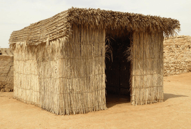
The archaeological story gets controversial when we ask about houses
The traditional interpretation: Caton-Thompson and Gardner called Kom W and Kom K villages. That interpretation became enormously influential. The modern problem. Recent re-examination has found: many hearths, pottery, stone tools, food remains and storage. But very little direct evidence of substantial houses.
There are no convincing concentrations of: stone foundations; mudbrick walls; substantial post-built houses; and permanent floors. And, recent geoarchaeological research argues that wind erosion and deflation have destroyed or removed much of the evidence that might once have demonstrated village architecture. But researchers also emphasize that we should not simply assume houses existed because the people were farmers. (4,5)
It is absolutely possible there could have been huts
Light structures made from: reeds; grasses; wood; mats; fibres; and hides. Could leave almost nothing archaeologically. There are also postholes in some Fayum contexts outside the principal Kom W/Kom K evidence. But for the specific stratified Kom W/Kom K deposits. There is currently no secure architectural plan of a Neolithic house. The architecture we can prove consists primarily of pits, hearths, storage, pottery, fibre technology and activity surfaces. The absence of mudbrick architecture may reflect a genuinely lightweight settlement; mobile/semi-sedentary occupation; erosion and deflation; structures made from organic materials; and/or some combination of all four.
Timber frames?
The preservation environment is terrible for wood. Wind has removed sediments, organic material decomposes, and ancient surfaces have been exposed and disturbed. The absence of timber does not prove that timber wasn’t used.
Wattle and daub?
Also Possible, but not demonstrated as clearly as at sites such as Merimde.
If we had to illustrate we could label: “Hypothetical reconstruction based on the use of perishable architecture in the Fayum and comparable Egyptian Neolithic sites.” Rather than presenting it as an excavated building.
One of the strongest architectural signals is: Lots of hearths
Kom W contained approximately 248 features interpreted by the original excavators as hearths/fire-holes. (1,4) Modern research has re-examined these features rather than simply accepting the old interpretation. Some are genuine combustion features. Some may represent different activities. But the concentration of hearths demonstrates intensive use of the landscape.
Some Fayum hearths were constructed with concentrations of stones that could absorb and retain heat
These features are visible today as concentrations of burnt stone and charcoal. They are especially useful because the stone survives after the organic architecture has vanished. (15)
There is no large, specialized communal or oven bakery comparable to much later Egyptian settlements
No securely identifiable furniture assemblage has survived
There are no famous Fayum Neolithic chairs or beds. But woven mats and baskets almost certainly played many roles. Organic technology has probably disappeared far more completely than stone technology.
Real architecture may have been portable
Instead of thinking: “Where is the house?” ask: “Where is the infrastructure?” The infrastructure included: storage pits; hearths; fishing places; grinding stones; basketry; pottery; pathways; activity zones; and animal-processing areas. Some of that could stay in place while people moved between resource zones. That is why recent researchers have emphasized mobility rather than simply “village vs. nomad.” (5,14)
Were they farmers? Yes but “farmer” alone is misleading
The Fayum Neolithic contains some of the earliest secure evidence for domesticated cereals in North Africa. But animal bones show something extraordinary: Fish overwhelmingly dominate the faunal assemblage. This means these people were not abandoning fishing in favour of agriculture. They were adding agriculture to an already highly productive aquatic economy. (6)
Fish were probably more important than livestock
This is one of the most important corrections to the old picture. The faunal assemblages contain: huge quantities of fish; freshwater molluscs; aquatic/wetland species; wild mammals; domestic cattle; sheep/goat; pig; and dog. The researchers conclude that fish dominate the animal bone record despite the presence of domesticates. (6)
The economic model is better represented as fishing, hunting, gathering, livestock and cereal cultivation. Rather than: wheat farmers with a few fish.
The Fayum’s freshwater environment supported a rich Nile fish community
Archaeological studies identify a variety of fish, with fish forming the dominant animal-resource category.
Hippos, crocodiles and other big animals. Yes
The wider Fayum Neolithic faunal record contains remains of large aquatic animals including: hippopotamus, crocodile, elephant in the broader Fayum record, wild cattle/bovids, hartebeest and other game animals. The older archaeological record famously includes hippo remains and hippo tusks from Kom W. (16) A dramatic reminder: The Neolithic Fayum was not today’s quiet, hypersaline Lake Qarun surrounded by desert. It was part of a much richer Nile-connected wetland ecosystem.
Pigs, cattle, sheep and goats
All are represented. Domestic animals identified from the renewed Kom K/Kom W excavations include: cattle; sheep; goats; pigs; and dogs. But they were not the dominant food resource. The strongest conclusion is: livestock were important, but aquatic resources remained fundamental. (6)
Snails and freshwater molluscs
Yes. Freshwater molluscs occur in the faunal record. Some shells may be food refuse; others may be intrusive, so archaeologists carefully distinguish the two. This is another reason the lake-margin environment matters.
Turtles?
Freshwater aquatic fauna included various small vertebrates, and turtle remains occur in the wider Fayum archaeological record. But turtle is not nearly as diagnostic for Kom W/Kom K as fish.
Were they nomadic or sedentary?
This is perhaps the biggest archaeological question surrounding Kom W. Old interpretation: settled farming village. Alternative interpretation: mobile or semi-mobile food-producing community. Current position: Probably more complicated than either label. There is evidence for: cereal cultivation; storage; livestock; pottery; and long-term landscape use. But also: mobility in lithic procurement/use; lack of substantial houses; enormous reliance on fishing; scattered occupation sites; and storage systems that could facilitate movement. Modern landscape archaeology therefore favors a flexible low-level food-producing system, potentially involving seasonal or logistical mobility. (3,5,14)
It could have been “para-agricultural”
Ie. agriculture was present, but it did not replace fishing, hunting, gathering and mobility. The Fayum people may have been doing something very clever. Grow grain when conditions allowed, store it, fish when fish were abundant, hunt, herd animals and move between productive locations. That is much more resilient than betting everything on a single crop.
Did they irrigate?
There is no evidence of a large artificial irrigation network around Kom W or Kom K. Their agricultural system probably relied on natural soil moisture; seasonal flooding; rainfall; groundwater; and suitable lake-margin/floodplain soils. The lake and surround environment gave them an unusually good risk-reduction strategy.
Stone tools
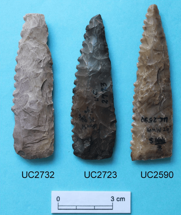
Kom W produced a remarkable stone-tool assemblage. The Petrie Museum records 75 axes, including tools made from: chert; basalt; dolerite; limestone; and volcanic stone. Chert dominates the axe assemblage. (17) There were also: sickle blades; projectile points; scrapers; knives; adzes; gouges; microliths; and grinding stones.
What were the axes for?
This is a particularly interesting modern research question. The axes could have been used for: woodworking; clearing vegetation; constructing shelters; processing timber; and perhaps boat-related activities. Noriyuki Shirai has specifically re-examined the Fayum axe assemblage to investigate what these tools tell us about woodworking and the lifeways of early Egyptian farmers. (18) Directly relevant to our databases on Neolithic construction tools.
The wooden sickle
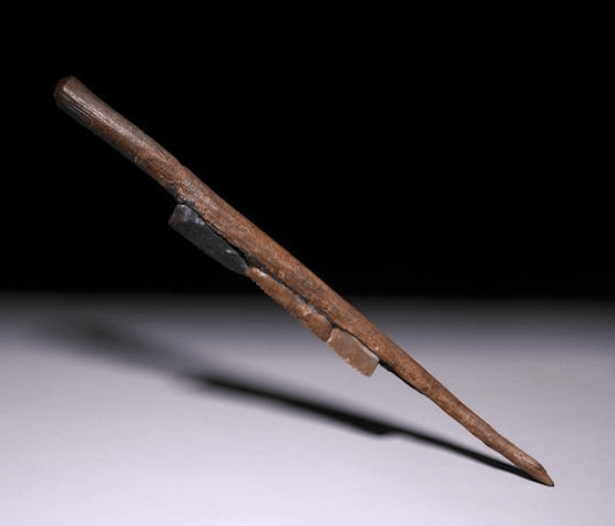
One of the remarkable finds from Kom K is a wooden sickle, with blades added in modern museum display. This is significant because the wood itself is extraordinarily rare survival. It demonstrates that Neolithic technology wasn’t just a flint blade. It was a wood and stone blade, adhesive/hafting technology and human hand. That’s a complete tool system. (19)
Kom W is one of the important early Egyptian ceramic assemblages
The pottery includes: bowls; cooking vessels; storage vessels; cups; pedestalled vessels; and unusual rectangular dishes/basins. Some vessels were used for: cooking; storage; transporting food; water; and processing materials. Modern analysis suggests that some vessels were specifically associated with storage. (20)
Pottery technology
The pottery was generally: handmade; relatively coarse; often straw-tempered; and unevenly fired. Early pottery can look “crude” compared with later Egyptian ceramics, but that is misleading. The technology was perfectly adequate for: boiling, cooking, carrying, storing and processing. And, ceramic vessels were another form of portable architecture.
Red ochre was present
It may have had several uses: pigment; ceramic surface treatment; symbolic activity; and possibly body decoration. At Kom W, red ochre was also considered in relation to red ceramic slip. (21)
Burials and funerary technology
This is an important difference from some Egyptian Neolithic sites. Kom W and Kom K do not provide a major, well-preserved cemetery comparable to the Badarian cemeteries. The famous evidence is instead settlement, hearths, storage, tools and food remains.
There are burials in the broader Fayum Neolithic landscape, but the principal significance of Kom W/Kom K is not elaborate funerary architecture.
A burial comparison
Site Funerary emphasis
Nabta Playa strong ceremonial/burial traditions
Badari very strong cemetery tradition
El Omari settlement burials
Kom W/K comparatively weak/poorly preserved burial evidence
Naqada increasingly elaborate Predynastic cemeteries
They had textile technology
Flax and linen technology is present in the Fayum Neolithic. The Petrie Museum preserves Fayum examples of linen and plant-fibre technology. (1) This matters because it gives us another technological chain flax plant, fibre, thread and textile. While simultaneously: grass/reed, fibre, basket and storage architecture.
Fibre technology may have been more important than pottery
This is one of the most exciting conclusions from modern work. Pottery and Stone survives. Basketry usually does not. Yet the Upper K pits preserve enough fibre technology to demonstrate that the Fayum Neolithic had highly developed basketry knowledge. (14)
This suggests that our conventional archaeological picture may be biased toward stone and ceramic. When the real material culture included enormous quantities of fibre, wood, reed, grass and leather.

Trade was almost certainly. The material record indicates connections beyond the immediate Fayum
Personal ornaments include: ostrich-eggshell beads; shell ornaments; bone rings; stone beads; and perforated pebbles. The presence of marine shell is especially interesting because the Fayum is inland. That implies acquisition through exchange networks or movement between ecological regions. (22)
Gold, copper and metal?
Kom W did not produce a significant metal-working tradition. Older studies noted that metal was essentially absent from the Fayum A material, apart from ochre and mineral pigments. (23)
The most important “resource” may have been the landscape itself
The Fayum gave them: fish; freshwater; reeds; wild plants; grazing; cultivable soils; clay; stone; wood; shell; and wild animals. It was essentially an oasis-sized ecological machine.
Was Lake Qarun freshwater?
During the Neolithic, the lake was substantially more freshwater influenced than the modern lake. Modern Lake Qarun is saline/brackish, but prehistoric conditions varied with: Nile inflow; evaporation; lake level; and connection to the Nile. Sediment cores can distinguish periods of higher/fresher versus lower/saltier lake conditions using sedimentology, minerals and diatoms. (24)
When did the environment become dramatically more arid?
The broad African Humid Period ended progressively rather than instantaneously. For the Fayum, major lake-level changes occurred during the Holocene, with particularly important fluctuations around the 7th–5th millennia BC and later. The dramatic aridification of the Sahara was broadly underway by the late 5th/4th millennium BC, although local hydrological changes varied. Kom W and Kom K existed during a period of changing hydroclimate in which lake level, Nile flooding and rainfall were already influencing the landscape.
We don’t know why they left
And, this is one of the places where archaeological science should resist a dramatic story. Possible factors include: changing lake levels; changing flood regimes; changing availability of wetland resources; changing agricultural opportunities; mobility into other parts of the Fayum; broader changes in Egyptian settlement patterns; and interaction with other communities. The evidence does not demonstrate a single abandonment catastrophe.
Were the sites abandoned because the lake dried up?
Not simply. The lake survived for thousands of years after the Neolithic. But the productive edges of the lake was located changed. As water levels changed, people could move with the resource zone. This is another reason the absence of permanent houses may actually be meaningful.
Nowadays, the area around Kom K in particular has been heavily affected by modern agricultural development (25)
Between 1924 and 1928, British archaeologist Gertrude Caton-Thompson and geologist Elinor Wight Gardner investigated the Fayum. Their work transformed the archaeology of prehistoric Egypt. Kom W became the type site for the Fayum Neolithic. And, the discovery of the K pits was partly accidental: Gardner identified the remarkable storage installations on a higher ridge north of Kom K. The first radiocarbon measurements came much later, in the 1950s, and modern AMS dating dramatically refined the chronology. (3,14)
What was left from the 1920s excavations?
Baulks; unexcavated areas; lower deposits; and material beneath old trenches. Modern researchers could apply: AMS radiocarbon; GIS; magnetometry; zooarchaeology; archaeobotany; sediment analysis; spatial analysis; and modern lithic technology studies. This radically changed the interpretation.
One of the most important discoveries: the “village” may not be a village
This is perhaps the most important modern interpretation. Caton-Thompson saw: Kom W = village. Later researchers questioned this. Wind erosion has removed huge amounts of sediment around the site, and the original archaeological surface has been heavily altered. The modern research suggests that the surviving deposits may represent a specialized activity concentration within a much larger mobile or semi-mobile landscape rather than a conventional permanent village. (4,5) This doesn’t mean there were no houses. It means there’s not the evidence needed to prove a permanent village.
Kom W may represent something architects sometimes overlook: Infrastructure without monumental buildings
The architecture consisted of: storage, fire, water, food processing, fishing, basketry, paths, temporary structures and landscape knowledge. Rather than walls, streets, houses and temple. It is architecture as systems engineering.
A possible Kom W household: A cautious reconstruction
Near the lake: fishing, nets and fish processing. A little farther inland: hearth, grinding, cooking and pottery. On higher ground: basket-lined grain storage. Nearby temporary/lightweight shelter. Beyond: cattle, sheep/goats and pigs. And across the landscape: hunting, gathering + movement between resource zones. Probably closer to the archaeological reality than a neat row of permanent mudbrick houses.
Kom W/K versus Badari
Region Fayum Upper Egypt
Environment Lake/wetland + desert Nile floodplain + desert
Main date ~4650–4350 BC ~4400–3800 BC
Agriculture Yes Yes
Fishing Extremely important Important
Cattle Yes Yes
Pig Yes Yes
Architecture poorly preserved/light mostly light structures
Storage exceptional important
Basket-lined granaries Yes less characteristic
Houses uncertain poorly preserved
Cemetery limited major
Metal negligible more evidence
Textiles/fibre Yes Yes
Lake central no
Mobility probably substantial more settled/funerary emphasis
Kom W and Kom K versus El Omari
Nile connection Lake/Fayum system Direct Nile Valley
Water Lake Qarun Nile + springs/wadi
Agriculture Yes Yes
Fishing Dominant Important
Pig Yes Strong
Cattle Yes Strong
Architecture Uncertain/light Semi-subterranean/light huts
Storage Huge importance Important
Basketry Exceptional Important
Burials Limited Strong settlement-burial evidence
Climate setting Lake/wetland/desert Nile/wadi/desert
Mobility strong possibility semi-sedentary
These makes them excellent complementary case studies.
There is no securely identified temple, shrine, communal hall or monumental ceremonial building at Kom W/K
This does not mean they had no ritual behavior. Personal ornaments, ochre, unusual objects and mortuary practices elsewhere in the Fayum demonstrate symbolic behavior.
The most convincing communal-looking infrastructure is actually storage
Imagine many people contributing grain to a shared storage system. A basket-lined silo is not glamorous, but it represents: collective planning; food security; labour; seasonal forecasting; property; cooperation; protection from moisture; and possibly social obligations. In that sense, the granary may have been more socially important than the house.
The Fayum was not isolated
Trade and long distance objects included marine shell; ostrich eggshell; non-local stones; distinctive lithic materials; and ornaments. The material network connects the Fayum to wider North African and northeastern African exchange systems. (22)
Was there a connection to the Mediterranean?
Yes, indirectly. The Mediterranean coast is well north of the Fayum, roughly on the order of 150–200 km away by straight-line/geographic approximation, depending on which coastal point is used. So this was not a coastal settlement. But shells and other materials demonstrate that the people were participating in exchange networks extending beyond the immediate lake basin.
There is no strong evidence for a specialized Neolithic medical system at Kom W/K
But the community possessed technologies that would have had health-related applications: flax; fibre; bandage-like textile material; plant knowledge; bone tools; grinding technology; mineral pigments. We should not label these “medicine” unless direct evidence supports it.
The climate story timeline
10,000 years ago: The Sahara and North Africa were generally much wetter than today.
8,000 years ago: The African Humid Period was strong, but the Nile/Fayum already experienced hydrological fluctuations.
7,400 BC: Early Holocene human activity is securely documented in the Fayum.
6000 BC: The Qarunian tradition disappears and there is an apparent occupation gap.
5200–5000 BC: The Fayum is reoccupied by communities using domestic plants/animals.
4650–4350 BC: Kom W and Kom K’s principal stratified occupation.
5th–4th millennium BC: Increasing aridification and changing Nile/lake conditions reshape the Egyptian landscape.
Later: The Fayum remains occupied, but its ecological and economic systems change repeatedly.
The Fayum is an exceptional natural laboratory
Researchers combine: Lake sediments. Changes in sediment composition reveal water conditions.
Diatoms. Freshwater versus more saline conditions can be identified.
Geomorphology. Ancient lake beaches and shorelines show former water levels.
Radiocarbon. Dates archaeological hearths, charcoal and organic deposits.
Pollen/phytoliths. Reveal vegetation.
Archaeobotany. Shows cultivated and wild plants.
Zooarchaeology. Shows which animals people were exploiting.
GIS/remote sensing. Maps ancient shorelines and archaeological distributions.
This is much stronger than simply assuming that a desert today was a desert 6,000 years ago.
A valuable aspect the lake itself is a climate archive
Sediment cores from Lake Qarun preserve evidence for changes in: water level; salinity; Nile flood input; sediment sources; vegetation; and climate. Some sediment layers indicate higher, fresher lake conditions, while others indicate lower and more saline conditions. (24) Thus: archaeology tells us what humans did while lake sediment tells us what the water system was doing. Together they allow researchers to ask whether people moved because the lake changed—or whether people were adapting to changes that had already happened.
Kom W and Kom K research history is unusually rich
Early research. Gertrude Caton-Thompson. Archaeologist; principal early excavator.
Elinor Wight Gardner. Geologist and co-worker; crucial to the landscape and geological interpretation. Their major synthesis was: The Desert Fayum (1934).
Later work included renewed research around 2004–2006. Excavation, survey, GIS, geomorphology, archaeobotany, zooarchaeology and lithic studies. (3,14,25)
Is research still happening?
Yes, although much of the major fieldwork campaign has already occurred. The sites remain active subjects of archaeological reanalysis. Particularly important recent research includes: Kom W and Z Basin landscape/erosion studies; Fayum Neolithic stone axes; pottery function; basketry; mobility; zooarchaeology; and lake-level reconstruction. Noriyuki Shirai’s 2022 work is particularly useful for the ongoing debate about whether Kom W should really be called a “village.” (26)
A major modern problem is erosion because wind removes fine sediment
A process called deflation. It can leave behind: stone tools; pottery; bones; and burnt stones. While removing floors; mud walls; organic architecture; and lightweight structures. That means the archaeological record can become biased toward hard things.
Recent geomorphological research specifically demonstrates how wind erosion and deposition have changed Kom W since its formation. (5)
If we excavated a modern house after 6,500 years of desert wind, imagine what might survive
stone axe — yes
pottery — yes
fire-cracked stone — yes
bone — sometimes
brick wall — maybe
wooden frame — probably gone
reed wall — gone
basket — gone
rope — gone
mat — gone
leather roof — gone
wooden furniture — probably gone
So the surviving archaeology could make a highly sophisticated fibre-and-timber building society look like a collection of stones and pots.
The first farmers of the Fayum were not simply wheat farmers who settled beside a lake; they were highly adaptable people who combined fishing, hunting, gathering, livestock, cereal cultivation and extraordinary fibre-based storage technology in a landscape whose water level was constantly changing.
Perhaps the most important architectural lesson is: a Neolithic settlement does not have to be a village of permanent houses. At Kom W and Kom K, the granary, hearth, lake, fishing place and landscape may have mattered more than the house.
References: [1] Caton-Thompson, G. & Gardner, E. W. (1934), The Desert Fayum. The foundational excavation publication.
[2] Linseele, V. et al. (2014), “New Archaeozoological Data from the Fayum ‘Neolithic’ with a Critical Assessment of the Evidence for Early Stock Keeping in Egypt,” PLOS ONE 9(10): e108517.
[3] Holdaway, S. et al. / Wendrich et al. (2010), “Dating stratified settlement sites at Kom K and Kom W: Fifth millennium BCE radiocarbon ages for the Fayum Neolithic.”
[4] UCL Petrie Museum, Fayum Neolithic / Kom W and Kom K. Useful catalogue of pottery, tools, basketry, linen and food-production evidence.
[5] Emmitt, J. et al. (2021), “Kom W and X Basin: Erosion, Deposition, and the Potential for Village Occupation,” African Archaeological Review.
[6] Linseele et al. (2014), faunal evidence demonstrating that fish dominate despite domestic livestock.
[7] Holdaway, S., Wendrich, W. et al., research on the Early–Middle Holocene Fayum landscape and earliest occupations.
[8] Wendorf, F. & Schild, R. (1976), important reassessment of Fayum environmental sequence and Qarunian/Fayum A chronology.
[9] Hassan, F. A., work on Holocene Nile flood and Lake Qarun fluctuations.
[10] Holdaway/Wendrich et al., AMS chronology of Kom W and Kom K.
[11] Marston, J. M., Holdaway, S. & Wendrich, W. (2017), “Early and Middle Holocene wood exploitation in the Fayum basin, Egypt,” The Holocene.
[12] PLOS ONE, discussion of the earliest Egyptian domesticated cereal evidence from Kom W/K.
[13] URU Fayum Project, documentation of the surviving Upper K basket-lined granary.
[14] Wendrich, W. & Holdaway, S. (2018), “Basket use, raw materials and arguments on early and Middle Holocene mobility in the Fayum, Egypt,” Quaternary International.
[15] Koopman et al., work on Fayum geomorphology and heat-retainer hearths.
[16] Hayes, W. C., Most Ancient Egypt, discussion of Fayum fauna and hippo remains.
[17] UCL Petrie Museum, catalogue of Kom W stone axes.
[18] Shirai, N. (2021), “Can One See the Wood for the Trees in Prehistoric Egypt? A Study of Fayum Neolithic Axes.”
[19] UCL Petrie Museum, Kom K wooden sickle and other finds.
[20] Phillipps et al., “Formation and function: Middle Holocene pottery from Kom W, Fayum, Egypt.”
[21] Research on Kom W ceramic manufacture and use, including red ochre/slip.
[22] Linseele et al., material and faunal evidence for exchange and non-local resources.
[23] Hayes, Most Ancient Egypt, Fayum A material culture and absence of metal.
[24] Baioumy et al., Lake Qarun sedimentary reconstruction and Holocene environmental change.
[25] URU Fayum Project field reports documenting modern agricultural/development threats.
[26] Shirai, N. (2022/2023), “Kom W and Z Basin: Surface Artifact Collection, Culture History, and the Argument Over Village Occupation,” African Archaeological Review.
Leave a Reply