<home # start here # guides # builds # services # shop # about # categories>

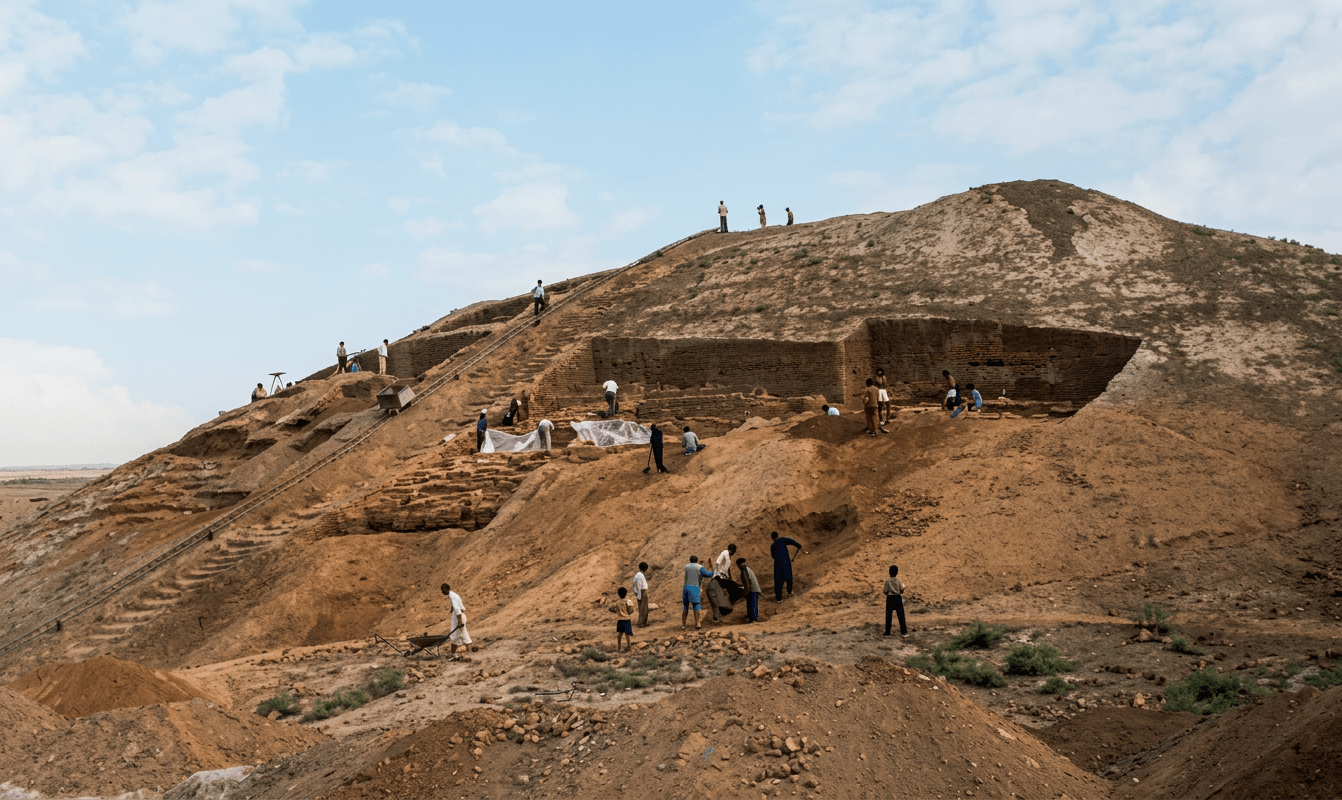
Cafer Höyük is a major Pre-Pottery Neolithic B site dating to around 9.5 and 8 thousand BCE
Located in the Upper Euphrates basin (Malatya region). It is one of the classic sites that shows the fully developing Neolithic “farming village package”. Domesticating cereals, sheep/goats, rectangular architecture, and structured domestic space. In the central fertile crescent.

Strongly RECTANGULAR and trapezoidal architecture
Cafer Höyük is famous because it represents the PPNB architectural revolution. Rectangular mudbrick houses, trapezoidal room layouts in some phases, plastered floors and internal divisions, clear household units arranged in clusters and planned village layout (not random circular clustering).
In Turkiye there was a major shift in the pre-pottery neolithic. From PPNA sites: round houses like Körtik, and Hallan Çemi; to rectangular planned villages (Cafer Höyük, others)

No clear “temples,” but structured village organization
No Göbekli Tepe style monumental enclosures. There is no single large communal temple building. However houses were clustered in organized blocks. With shared open spaces between buildings, and there is evidence of collective settlement planning and communal life. It was an urban-like village planning rather than monuments.
The site belongs to the stage where: Crops like domesticated einkorn wheat (Triticum monococcum), domesticated emmer wheat (Triticum dicoccum) and barley (Hordeum vulgare), became domesticated forms
They had sheep and goats
Domesticated sheep (Ovis aries) and goat (Capra hircus); and, aurochs bos primigenius (aurochs) appear. But wild equids (horses) are rare/absent.
It was a multi-phase PPNB village mound with repeated rebuilding
Researched by the French Anatolian Neolithic school starting in the 1960s–1970s. Including Jacques Cauvin’s and French CNRS prehistoric Near East teams.
7 to 9 thousand years ago the climate was different (more humid, mixed woodland-steppe, and agricultural stability)
- More humid Upper Euphrates. Stronger river systems and higher groundwater availability;
- Mixed woodland-steppe. Oak–pistachio forests nearby and grasslands in valley floors; and,
- High agricultural suitability. Natural cereal-growing zones, ideal for early farming expansion.
It is more degraded steppe conditions today
There are reduced woodland cover, more aridity and land-use pressure. Cafer Höyük sat in a more forested, wetter mosaic landscape, ideal for early agriculture, unlike the more semi-arid modern environment.
A stable farming communities within a wetter early Holocene environment. Cafer Höyük was a mature PPNB farming village in the Upper Euphrates valley with rectangular planned architecture, fully domesticated wheat and barley agriculture, established sheep/goat herding and hunting of wild aurochs. They had no horses but did have a socially organized settlement pattern, reflecting the transition from early Neolithic to experimental villages.

References: Cauvin, J. (French Near Eastern Neolithic synthesis framework)
CNRS Anatolian Neolithic excavation reports (Cafer Höyük publications)
Watkins, T. (Upper Euphrates Neolithic settlement studies)
Aurenche & Kozlowski (Near Eastern Neolithic architecture transitions)
Archaeological synthesis of PPNB Upper Euphrates corridor (Malatya region)
Leave a Reply